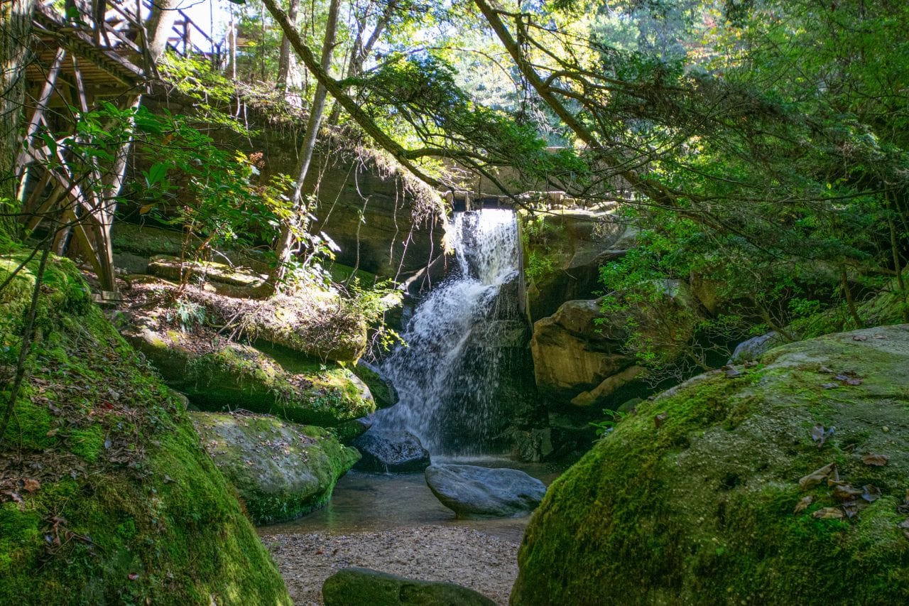
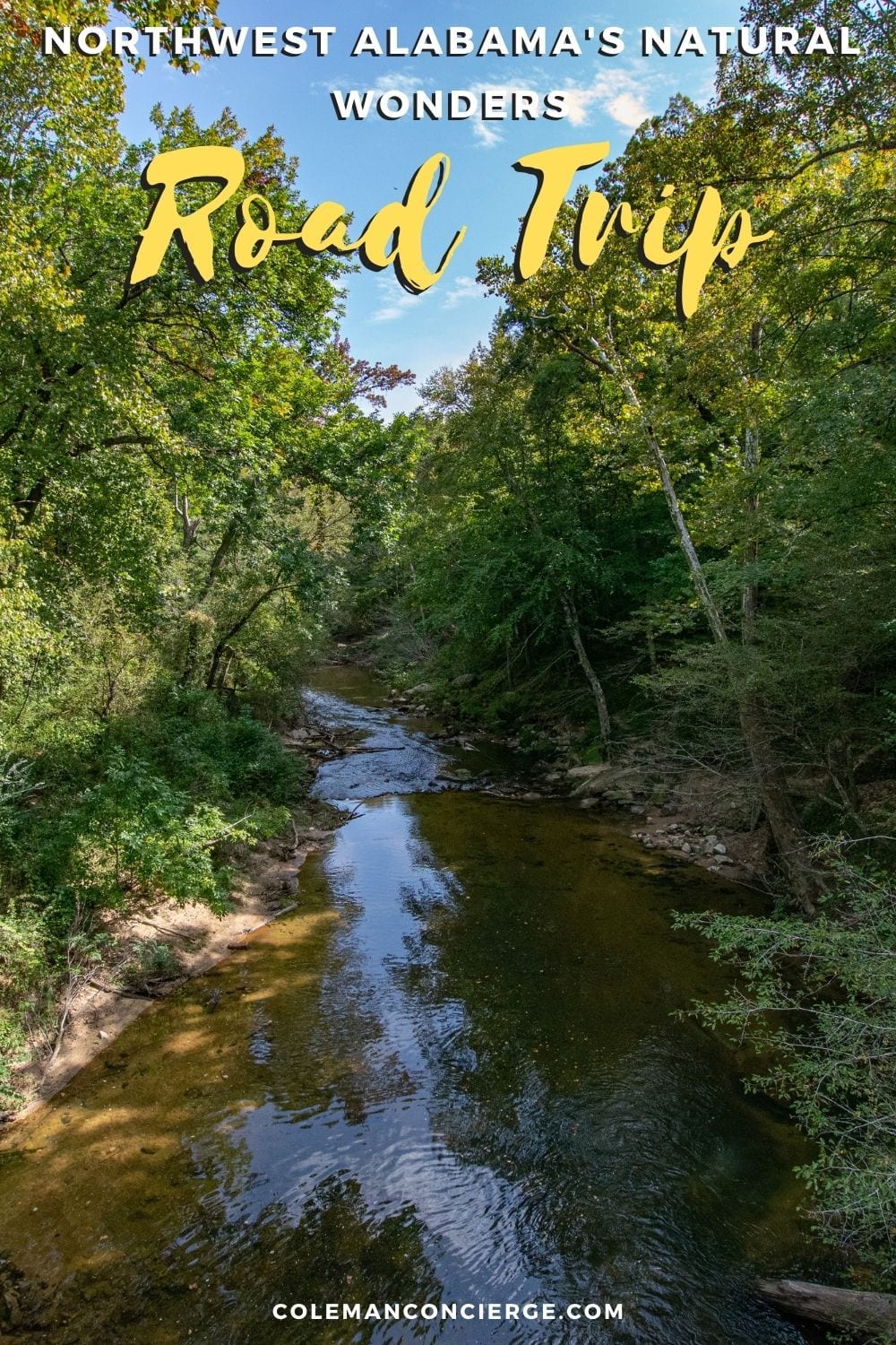
Gravel crunched under our tires as we pulled to a stop in a wide spot on the road at Kinlock Falls. As we opened our doors, we heard the sound of rushing water welcoming us to the Sipsey Wilderness and knew immediately why they call this the land of a thousand waterfalls.
We had arrived in the first federally designated wilderness east of the Mississippi, and the most visited National Forest in Alabama. Only, like most great road trips, this story is more about the journey than the destination.
From speeding down four-lane rural highways to crawling along gravel roads under a canopy of green, we experienced a little bit of everything on our northwest Alabama natural wonder road trip, including four of Alabama’s 20 natural wonders: Dismal Canyon, Natural Bridge, Bankhead National Forest, and the Sipsey Wilderness.
Moulton to the Sipsey River Trail
Moulton is the natural gateway to Bankhead National Forest from Memphis, Nashville, Huntsville, or Chattanooga. You can still make this day trip from Jackson or Birmingham, but you start and finish from Jasper with a little extra travel time. Moulton has a population just above 3,000, but you’ll find warm food, cold drinks, gas, and, most of all, flush toilets. Your next supply stop is a couple of hours down the road in Haleyville, so make sure you have what you need with you.
From Moulton, travel south on Al-33 into Bankhead National Forest. There are over 181,230 acres of recreational activities and 90-miles of trails in the forest. However, this morning we’re heading for Alabama’s only wild and scenic river – the Sipsey. Four miles after pulling onto Cranal Road, you reach the Sipsey River Picnic Area at the Sipsey River Trailhead.

Hiking the Headwaters of the Sipsey River
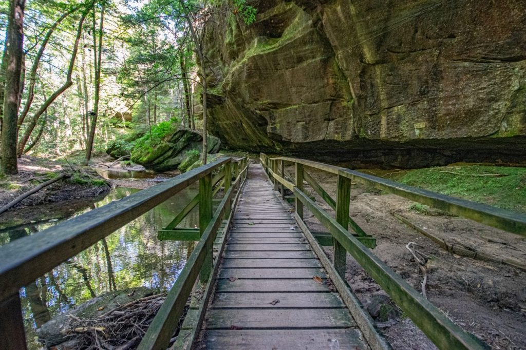
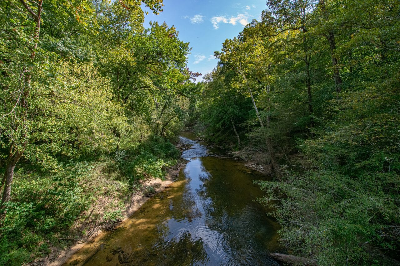
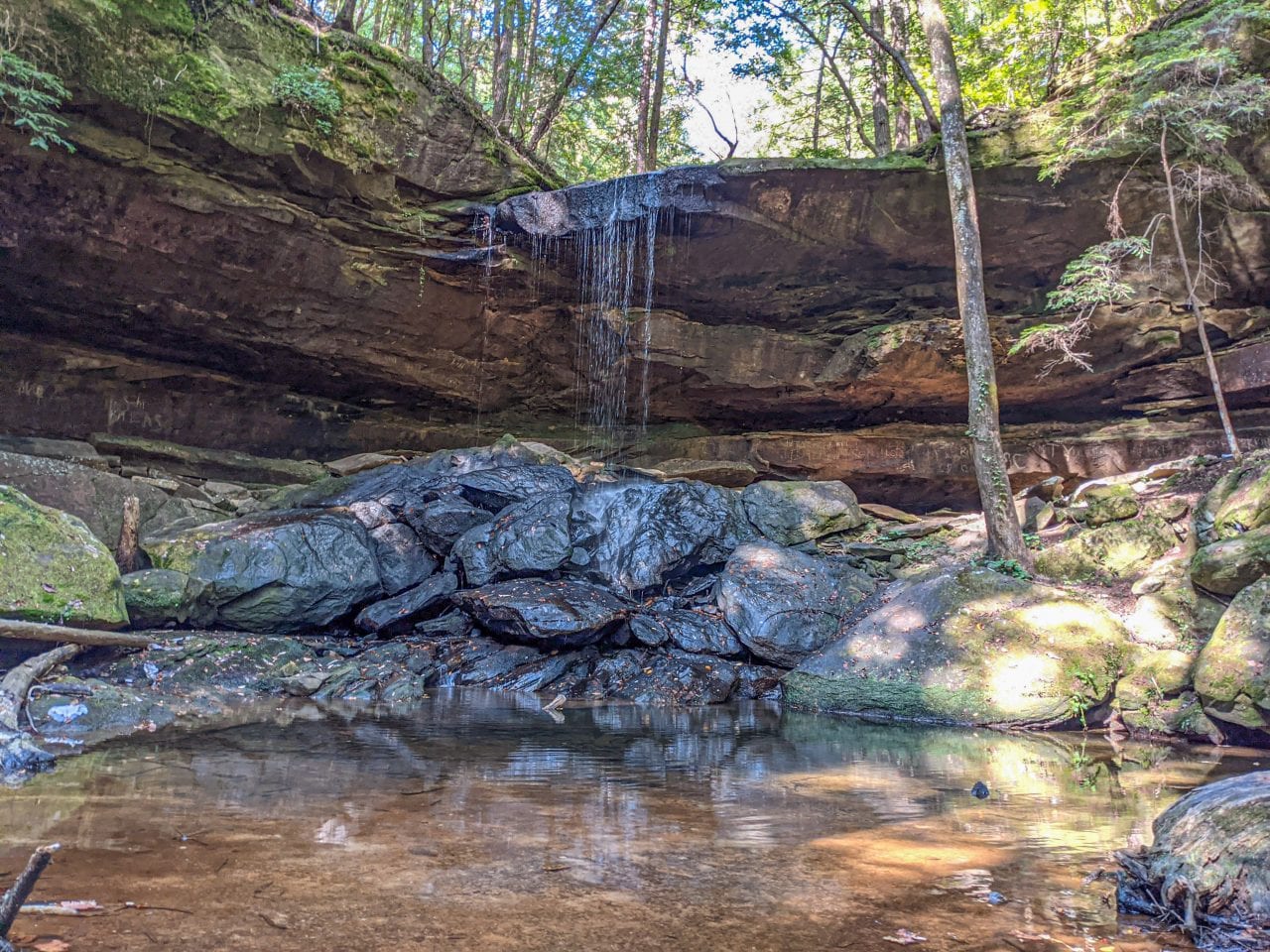
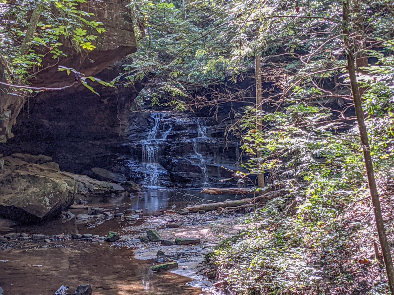
If you’re going to spend much time at the Sipsey River Picnic Area, you’ll want to bring two things: $3 for the day-use fee and hand sanitizer for the latrine. The Sipsey River flows 70-miles south to the Mulberry Fork, but this is your best access to the Sipsey Wilderness to the north. Heading upstream, you’ll find an easy hike to Falls Creek Falls or a more challenging route through Fat Man’s Squeeze on your way up Borden Creek. You can even explore for days on a 30-mile loop through the Sipsey Wilderness.
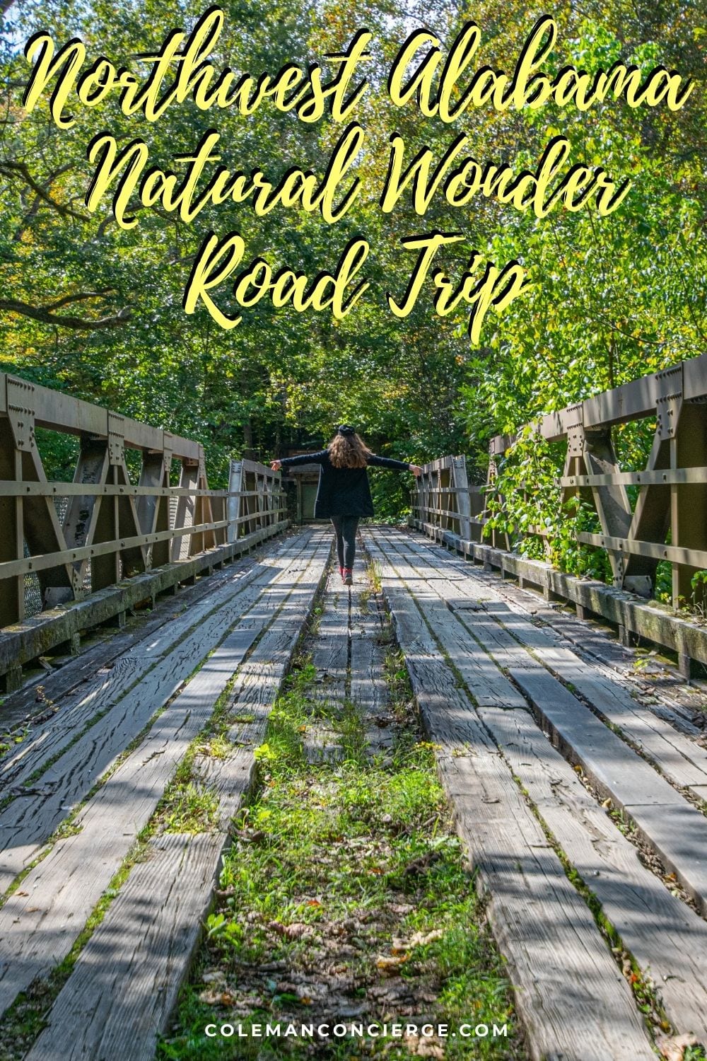
Any of these hikes would make for a day of adventure in and of themselves, but we’re on a road trip. So instead, we snapped a few pictures of the wooden bridge, used the facilities, and boogied on down the road.
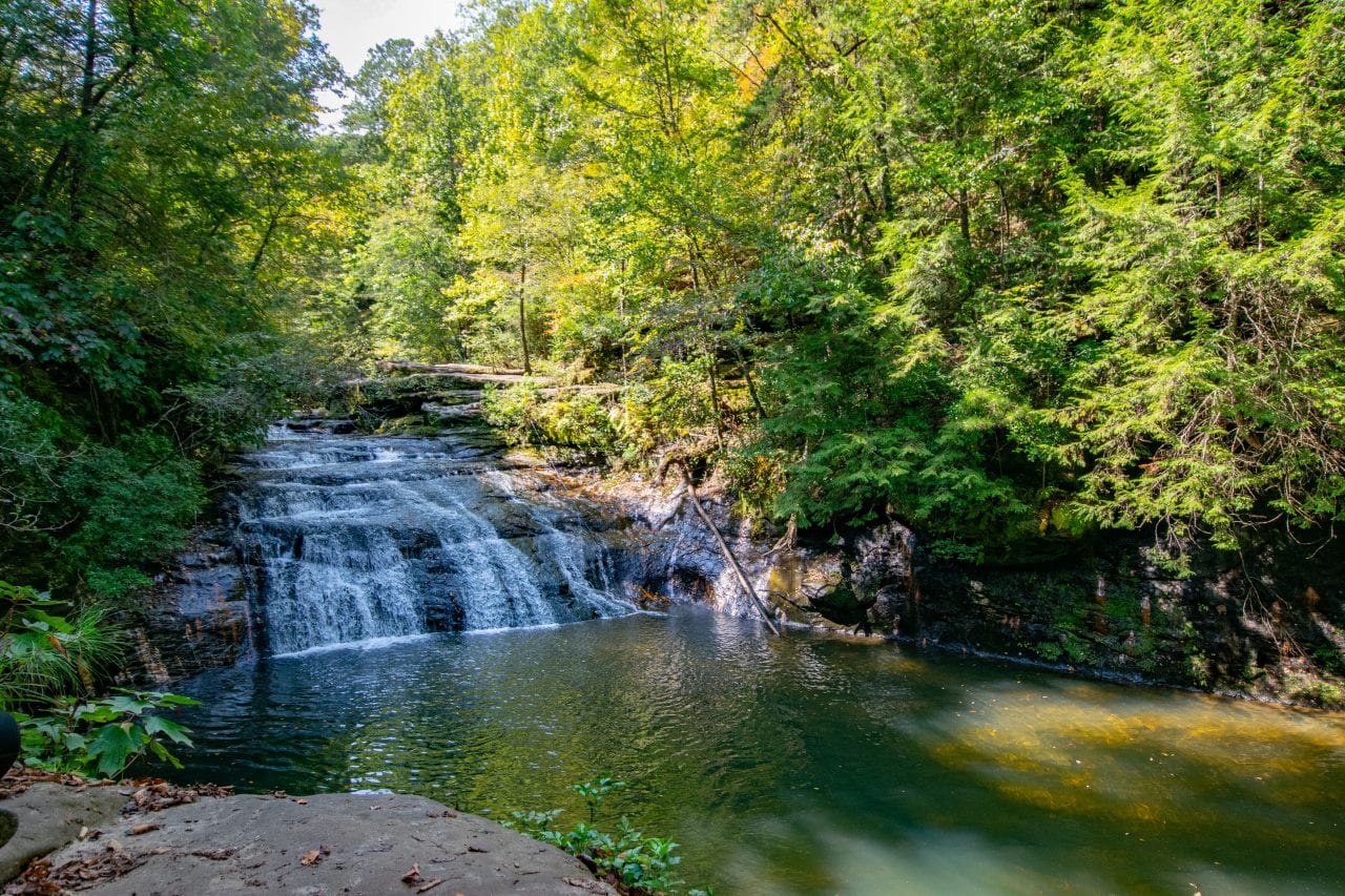
Sipsey River to Kinlock Falls
I think the time estimate for this segment is rather generous. Kinlock Road turns to gravel shortly after the connection with Cranal. Even if you could zip along at warp speed, why would you want to? This is the type of road that makes Sunday drivers happy, even if they’re driving a passenger car. It twists and turns through a tunnel of trees until you reach Kinlock Falls. BTW, if you pass the bridge, you’ve gone too far.
Once you reach the falls, there’s a short and well-kept path to a beautiful lookout over the basin. You’ll want to bring a hammock, or maybe a sandwich, or swim trunks. You might even bring all three and make a day of playing at the falls and exploring Kinlock Shelter a couple of miles up the road. But the road is calling, and we must answer. Reluctantly, we leave the beauty of Kinlock and pressed on to Natural Bridge.
Kinlock Falls to Natural Bridge
Leaving Kinlock Falls and the Sipsey Wilderness is a slow return to civilization. Gradually, the road turns to a paved country road, and then a rural highway. It’s about a 1/2 hour drive to Natural Bridge Park. If you need lunch, It’s only a couple minutes longer to route through Haleyville. Otherwise, let your GPS guide you in.
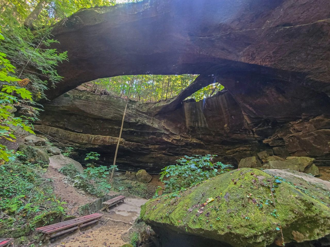
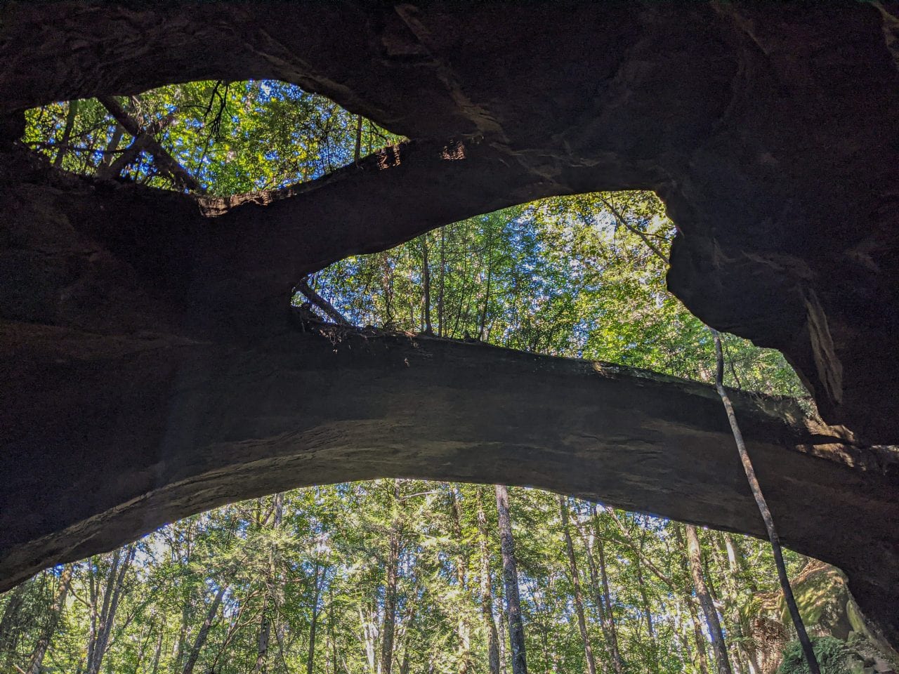
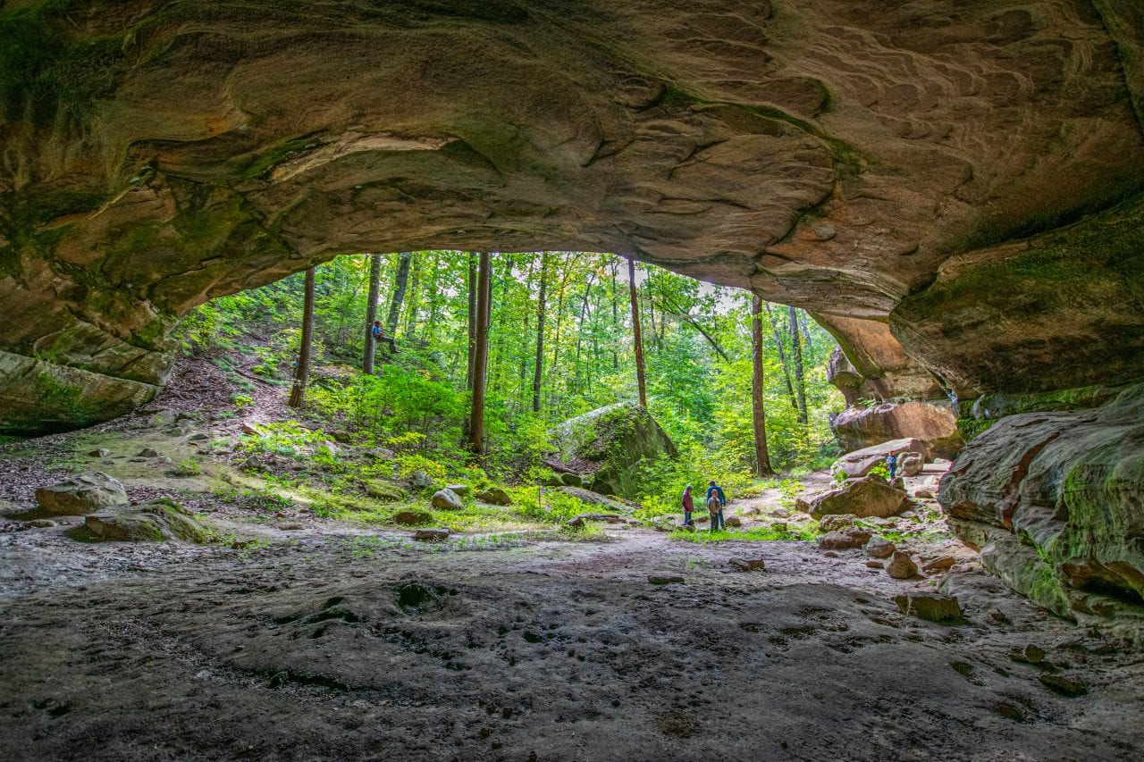
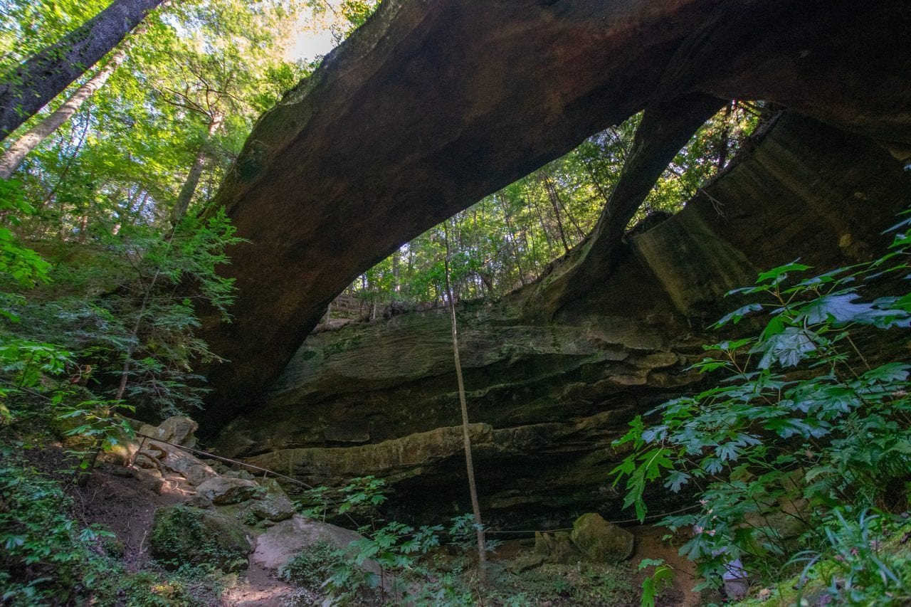
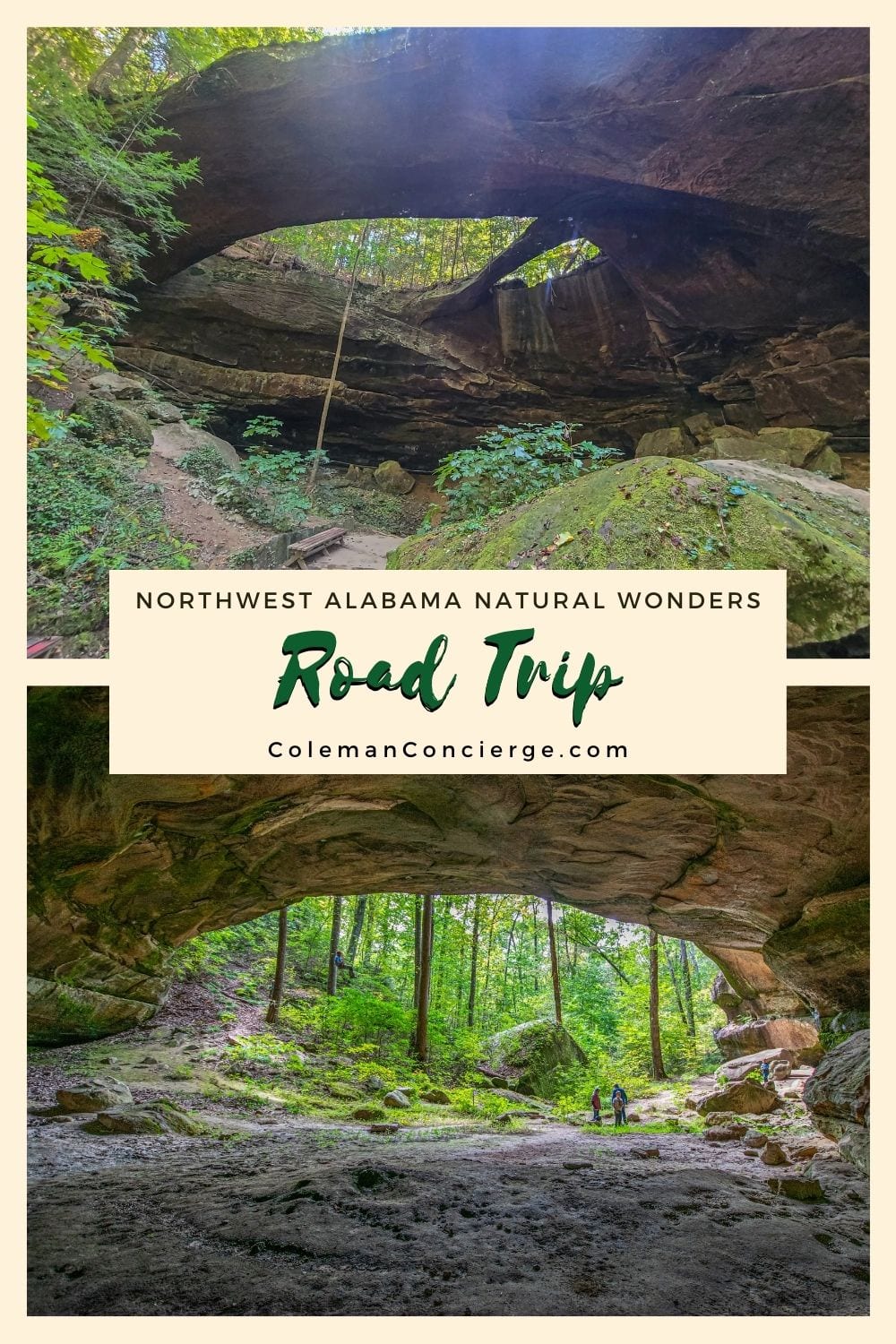
Natural Bridge Park is the largest natural bridge east of the Rockies, spanning 148′ and towering 60′ above the valley floor. The natural bridge formation dates back about 200 million years when water eroded the weaker sandstone. Stronger stone bridge spans remained, creating the structure we see today. You will probably spend less than an hour here hiking on the short trails and taking pictures of the arch, but it’s well worth the $3.50 admission cost.
Natural Bridge to Dismal Canyon
Visiting Dismal Canyon is the most logistically complicated portion of the natural wonder road trip because the experience changes so much with each season. During the summer, the cool misty canyon is a welcome relief from the heat. During winter, giant icicles form on the canyon walls during cold snaps. However, the most magical time to visit is nights during the spring and fall, when you can see the dismalites.
What are dismalites? They are the larvae stage of a species of insect (North American Orfelia fultoni) that emits a bright blue-green light to attract food. You can only find them in a few rare locations in the Appalachians with just the right amount of moisture and protection, as well as darkness to enjoy the light show. They are America’s cousins of the rare glowworms found in Australia and New Zealand.

How to See Dismalites in Dismal Canyon
There are two peak seasons for dismalites- the spring peak, late April through May, is the best. Then the fall peak is the end of September / through October. The larvae grow throughout the season, so they’ll be larger and brighter towards the end of each season. You need to make a reservation weeks in advance for a night tour, which only occurs on Saturday evenings. Thus, the logistic challenge. However, it’s worth putting a notification in your calendar so you can get this one booked.
Ideally, you show up in time for a combo trip of a day tour and night tour, as they are both different and unique. If you’re staying for a night tour, you can grab food in Haleyville on the way in if you have an early tour. If you got a late tour, which run as late as 9:15, you could leave Dismals and head into Hackleburg for a bite. We’d recommend El Fogon, a hidden gem of a Mexican restaurant located in the old bank in Hackleburg.
When you leave Dismal Canyon, you still have a 40-minutes drive to Moulton on AL-24. The road is perfect for night driving because it’s a divided highway with few twists and turns. However, you still need to make it home from Moulton, so you’re setting yourself up for a long day. Still, you got to see the first National Forest in Alabama, the first wilderness east of the Mississippi, the largest natural bridge east of the Rockies, and the rare and elusive dismalite glow worms all on one fabulous natural wonder road trip.

Logistics of the Northwest Alabama Natural Wonder Road Trip
Below is our sample itinerary and map for the Northwest Alabama Natural Wonder Road Trip. We’re assuming you’re going in spring or fall, and have called ahead well in advance to get your Dismal Canyon night tour tickets. We used Google Map travel times and distances and added padding at each stop so you can be chill as you explore Alabama’s natural wonders.
| Segment | Distance (mi) | Start | Finish |
|---|---|---|---|
| Moulton to the Sipsey River Trail | 18 | 9:30 | 10:00 |
| Hiking the Headwaters of the Sipsey River | N/A | 10:00 | 10:45 |
| Sipsey River to Kinlock Falls | 9 | 10:45 | 11:15 |
| Splashing in Kinlock Falls | N/A | 11:15 | 12:45 |
| Kinlock Falls to Natural Bridge | 23 | 12:45 | 13:15 |
| Exploring Natural Bridge | N/A | 13:15 | 14:00 |
| Natural Bridge to Dismal Canyon | 28 | 14:00 | 15:30 |
| Day Tour of Dismal Canyon | N/A | 15:30 | 17:00 |
| Dinner Run to Hackenburg | 15 | 17:00 | 18:30 |
| Night Tour of Dismal Canyon | N/A | 18:30 | 19:30 |
| Return to Moulton | 40 | 19:30 | 20:30 |
Like it? Pin it for later on Pinterest!


 Hi! We are Jenn and Ed Coleman, and together we are Coleman Concierge. It is our goal to inspire you to get out, expand your world, and to seek adventure, even in your own backyard.