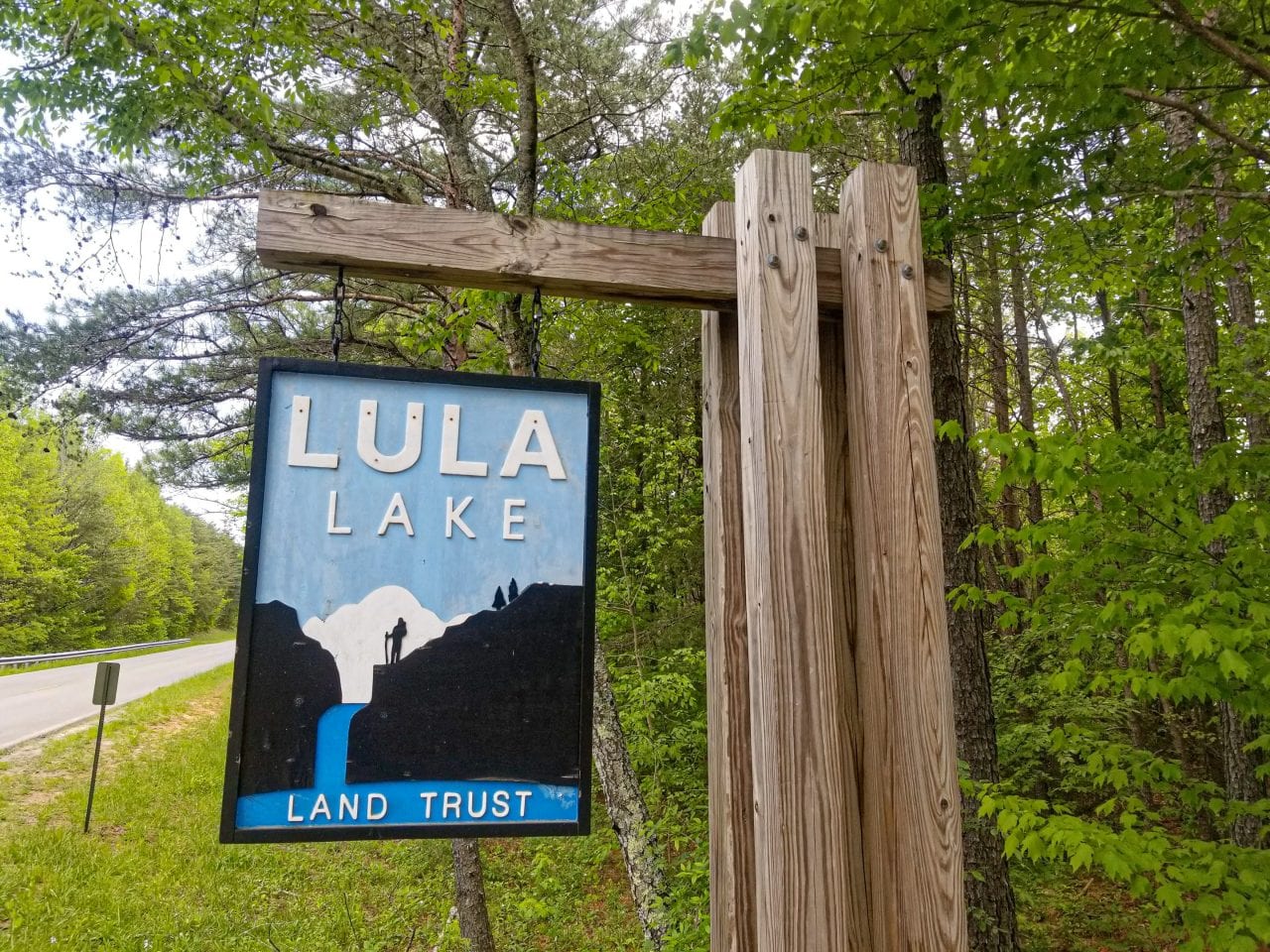
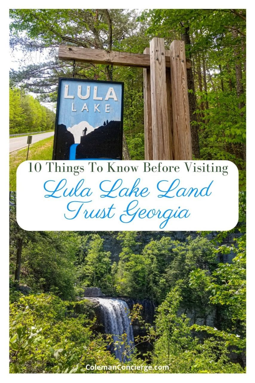
Imagine hiking through lush greenery to a sky blue lake and two waterfalls! Lula Lake trails are located just outside of Chattanooga on Lookout Mountain. Public access to Lula Lakes Land Trust is allowed by permit only about 40 days out of the year.
Between outdated information and the permit system, you might need a little help with your trip so we’ve written this guide to give you the ten things you need to know before visiting Lula Lakes. We hope it helps you enjoy and appreciate this remarkable natural area.
Do You Need a Permit to Visit Lula Lakes?
You need a permit to visit Lula Lakes. As of 2020, permits for day use are $15 / car and available online. 100% of the proceeds from the permits will be used to further conservation purposes. Permits are first come, first serve, and only available on the first and last weekends of the month. From December – April, Lula Lakes is only open on Saturdays from 9:00 to 5:00. From May – November, it’s also open from 12:00 to 5:00 on Sundays. The entrance gate closes at 3:30 because it will take at least 1 1/2 hours to visit Lula Lakes. Last, but not least, you need to remember that Lula Lakes Land Trust is in Georgia, which means that they run on the Eastern Time Zone. Alabama, just twenty minutes away, is in the Central Time Zone.
Pro-Tip – Be sure to sign up for your permit early, especially if you want to go on Saturday! We signed up a week in advance, and we were not able to get Saturday.
How Do You Get to Lula Lakes?
Lula Lakes is located on Lookout Mountain just across the Georgia State Line. It’s 15 minutes up the mountain from the bottom Incline Railroad Station and 10 minutes past Rock City on Lula Lakes Rd.
You should navigate to Lula Lakes Land Trust at 5000 Lula Lake Rd. If you put Lula Lakes in as a waypoint, you’ll go to a random point on the road. You need to go to the land trust gate to access Lula Lakes.
What Can You See at Lula Lakes?
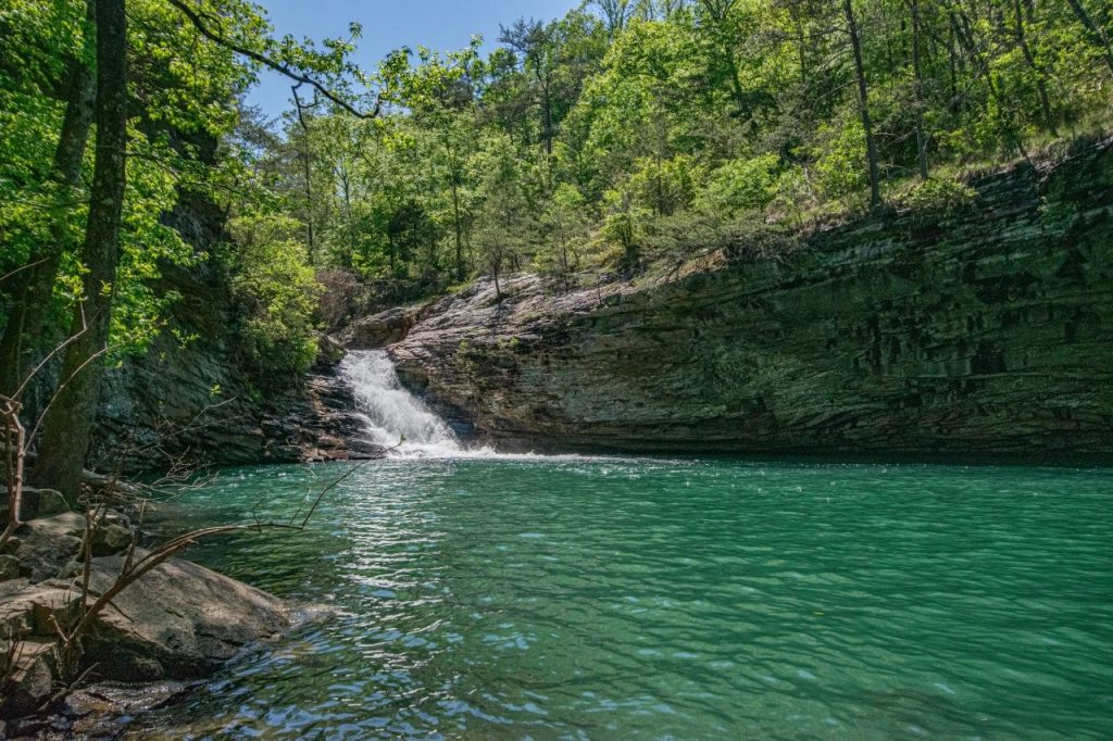
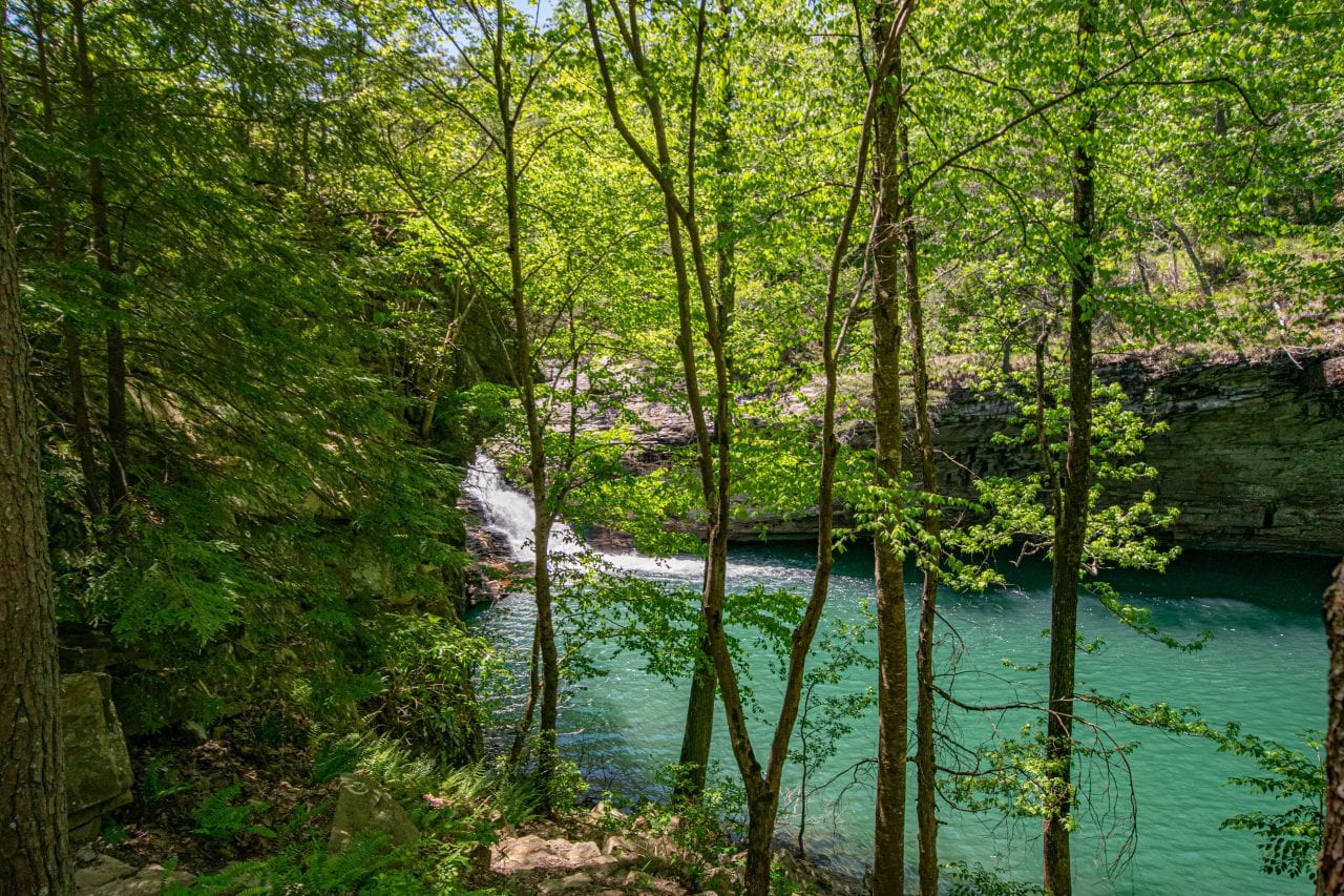
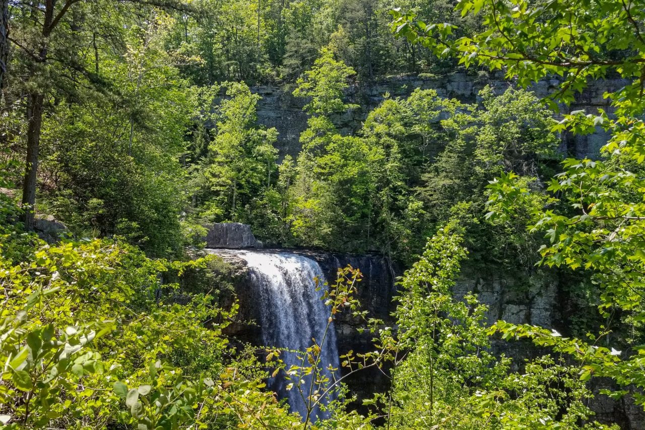
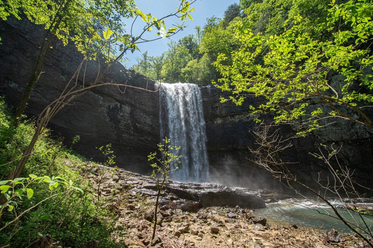
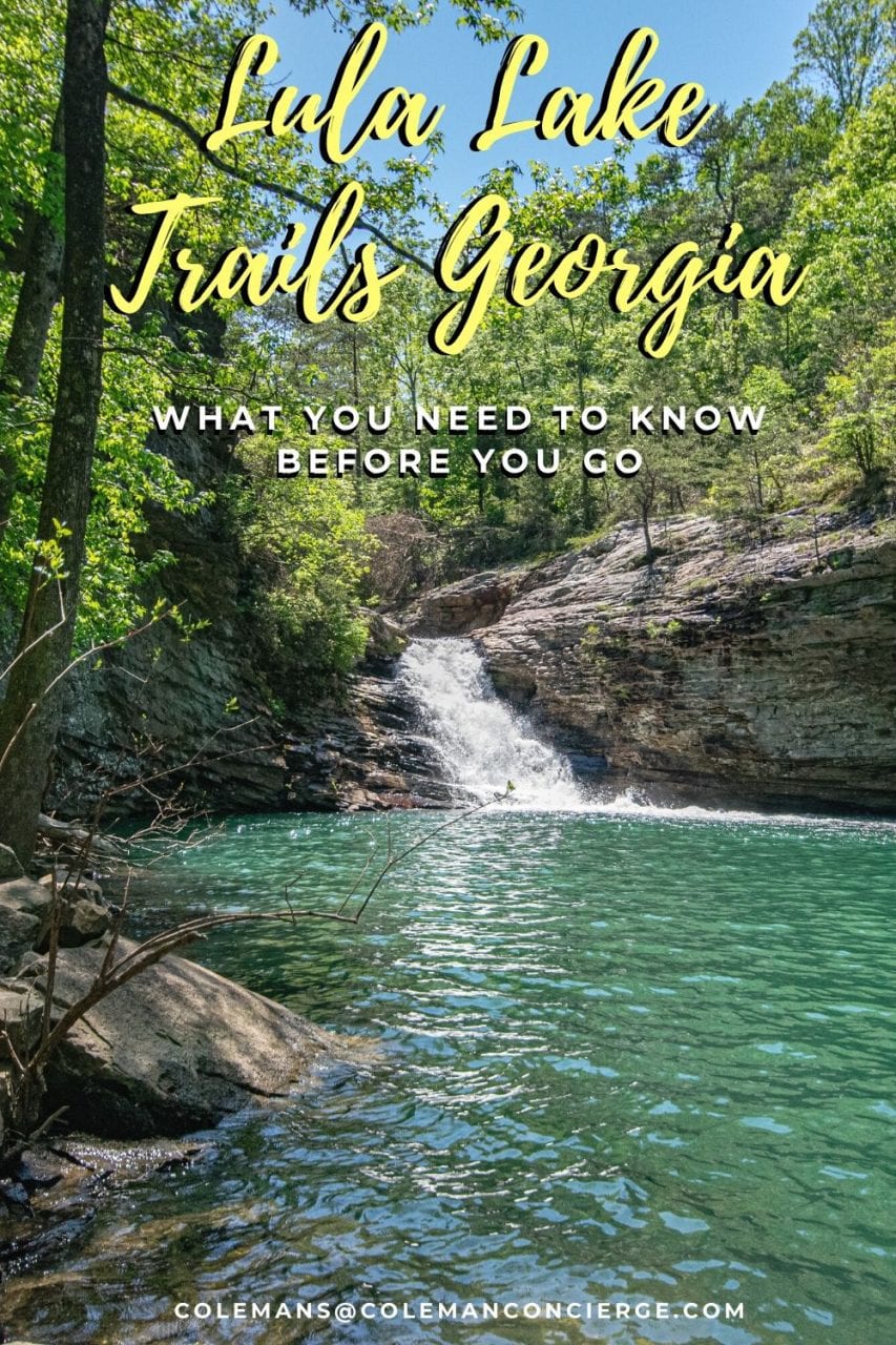
The Highlights of the land trust are Lula Lake and Lula Falls. Lula Lake is a small but beautiful blue lake with a 20-foot waterfall flowing into it (Upper Falls). Lula Falls is a 120′ waterfall about 0.1 miles below Lula Lake.
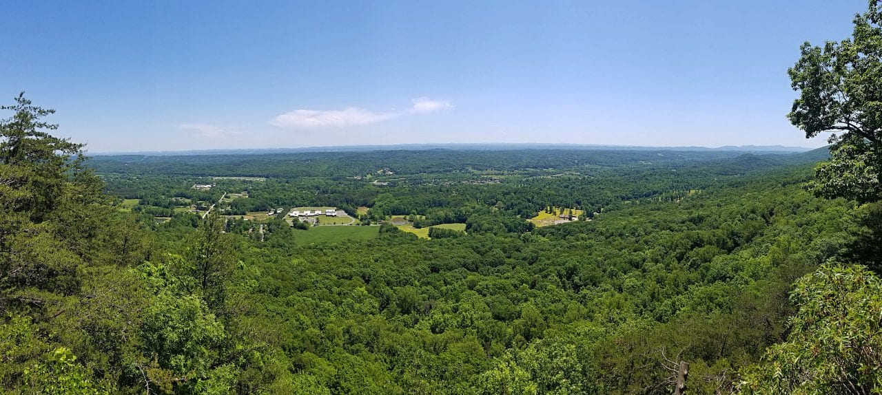
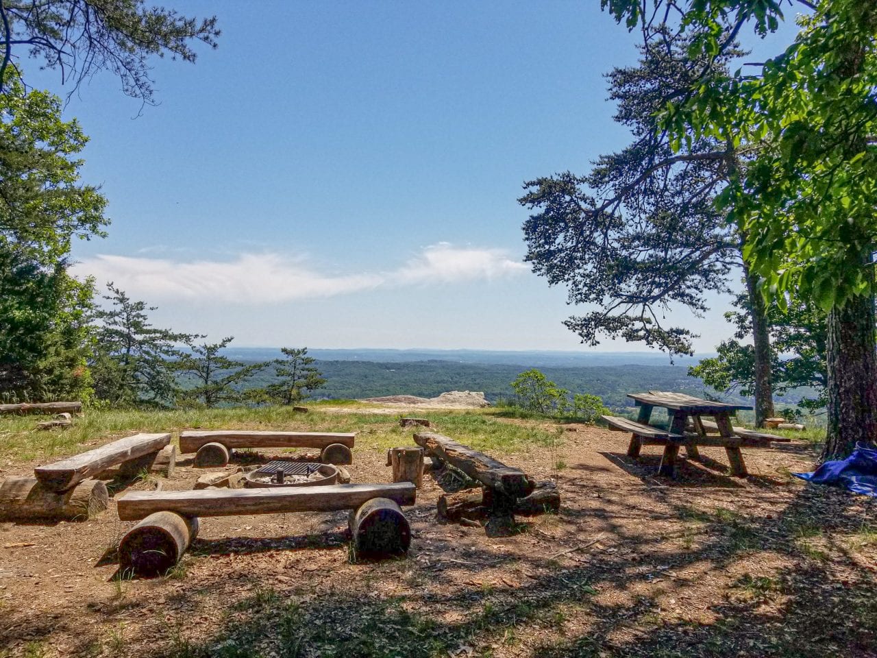
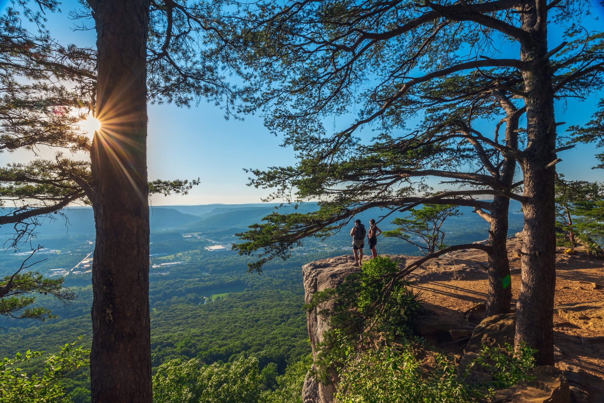
While the lake and falls are the highlights, there is a beautiful viewpoint from the Bluffline Trail that’s comparable to the lookout from Rock City, where you can ‘See Seven States.’ Whether or not you can see seven states from either location is debatable, but it’s certainly a great view.
How Far is it to Lula Lake From Your Car?
It’s about twice the distance to Lula Lake if you purchase a day permit than it is for annual pass holders. Why’s that? You have to park at the upper lot by the road if you have a day pass. Annual pass holders get to drive an additional mile down the hill and park by the maintenance shed. From the upper lot, it is a 3.2 mile round trip along the access road to get to Lula Lake. I would recommend planning for around four hours at Lula Falls, which allows you time to hike to the viewpoint, the falls, and Lula Lake from the upper parking lot and enjoy the sites along the way.

Can You Swim in Lula Lake?
You can not swim at Lula Lake. Swimming at the land trust is not permitted at any time. You will get your feet wet crossing Rock Creek at the aptly named Ford Trail, and might get some mist on you from Lula Falls, but you aren’t going to be swimming at Lula Lake.
How Hard Is the Hike to Lula Falls?
Lula Falls is only 0.1 miles past Lula Lake on the access road. It’s super easy to see the falls from the top. Reaching the bottom of the falls is another matter. Both the Old Lula Falls Trail and the Lula Falls Trail are about .1 miles long (so the map says…but it feels much longer). The Old Lula Falls Trail is closer, shorter, and steeper with railroad tie steps leading down the hillside, but make sure you are keeping your eyes peeled for poison ivy. The other way is longer and not as well maintained, but there isn’t the staircase. In our opinion, it’s moderately difficult, but the Old Trail is the easier option.
Pro tip: Download AllTrails+ for a one-stop shop app for planning all of your hiking, biking, and camping adventures.
What Are the Trails at Lula Falls?
Lula Falls Land Trust has 13 named trails with a total length of 7.65 miles plus several miles of access roads and connectors.
| Trail | Distance |
|---|---|
| Bluff Trail | 1.6 |
| High Adventure Trail | 0.2 |
| Ford Trail | 0.2 |
| Homestead Trail | 0.5 |
| Jedi Trail | 0.9 |
| Lula Falls Trail | 0.1 |
| Middle Trail | 1.1 |
| Nature Loop Trail | 0.2 |
| North Creek Trail | 0.5 |
| Old Lula Falls Trail | 0.1 |
| Ovenbird Trail | 0.25 |
| South Creet Trail | 1.1 |
| Turkey Trail | 0.9 |

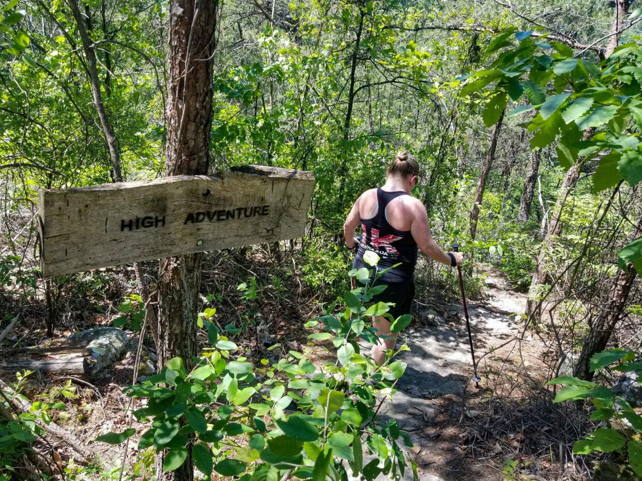
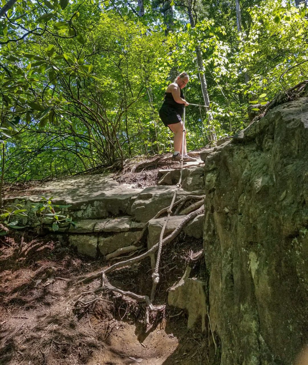
Why do they call it the Adventure Trail?
The moniker Adventure Trail usually describes a steep, overgrown trail. That’s certainly true here, but you should be aware that there’s a short (15′) section where you descend hand over hand on a fixed rope.
What Are the Trail Conditions Like for Mountain Biking?
Both of the Lula Falls trails and the Adventure Trail are unrideable, and you’re probably walking across the creek on the Ford Trail. Other than that, it’s relatively easy riding on access roads, double track, and a few single track sections.

Do the Lula Lake Trails Have any Facilities?
There are picnic tables on the bluff viewpoint, Lula Lake, and by the lower parking area. There are also pit toilets at the upper and lower parking lots. Other than that, Lula Lake has limited facilities other than wide trails and beautiful views. You should bring your own water and snacks, and plan on packing your trash out when hiking the Lula Lake trails.
Pro-Tip: We wrote an entire post on what to pack for a day hike 😉
Conclusion to Lula Lake Trails
We hope our tips help you plan your visit to the Lula Lake Trails. Lula Falls is one of the most beautiful waterfalls in Georgia, and a great alternative (or addition) to hiking Cloudland Canyon. While you’re heading to Lula Lake Land Trust, consider stopping by Rock City or Ruby Falls to complete your time on Lookout Mountain. Be sure to plan your entry time to Ruby Falls with the time it takes to hike Lula Falls so you can fit everything in, or go on two separate days while you’re chilling in Chattanooga.
Where to Stay near Lula Lake
Ready to Book Your Trip? These Links Will Make It Easy:
Car Rental:
- Need to rent a car? Discover Cars will get you on the road without breaking the bank!
- If you are brand loyal, you can also book directly through Alamo Rent-A-Car or Thrifty Rent-A-Car
Lodging:
- We loved staying and the beautiful all-inclusive Sandals Royal Curacao and we think you will too! Book your Sandals getaway now!
- From hotels to private homes, find the perfect accommodation with Hotels.com, VRBO, Expedia, or Booking.com.
- You can also book direct through Hilton Hotels
Our Packing Favs:
- Travel in style with a suitcase, carry-on, backpack, or handbag from Knack Bags
- Packing cubes make organized packing a breeze! We love these from Eagle Creek
Attractions/Activities:
- Save on tickets to attractions, sightseeing tours, and more with Tiqets
- Get Your Guide and Viator for guided tours/excursions, day trips, and activities
- Want to learn a city from the ground up? Take a small group walking tour with Walks – 5-star rated with a Tripadvisor Certificate of Excellence
- Want to book an epic adventure experience with top-notch companies like Intrepid Travel, G-Adventures, or Backroads? Check out Travelstride
- Find information on local trails with the All Trails App.
- Need something else to plan your perfect trip? Visit our Resources Page for more trusted partners
Like it? Pin it for later on Pinterest!


 Hi! We are Jenn and Ed Coleman, and together we are Coleman Concierge. It is our goal to inspire you to get out, expand your world, and to seek adventure, even in your own backyard.