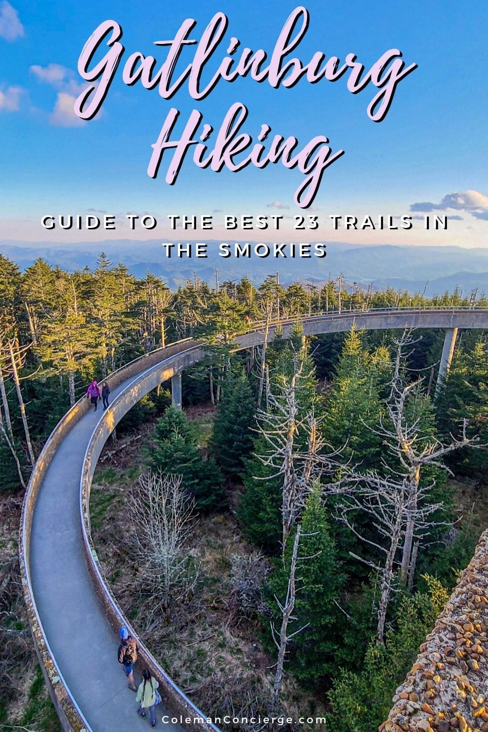
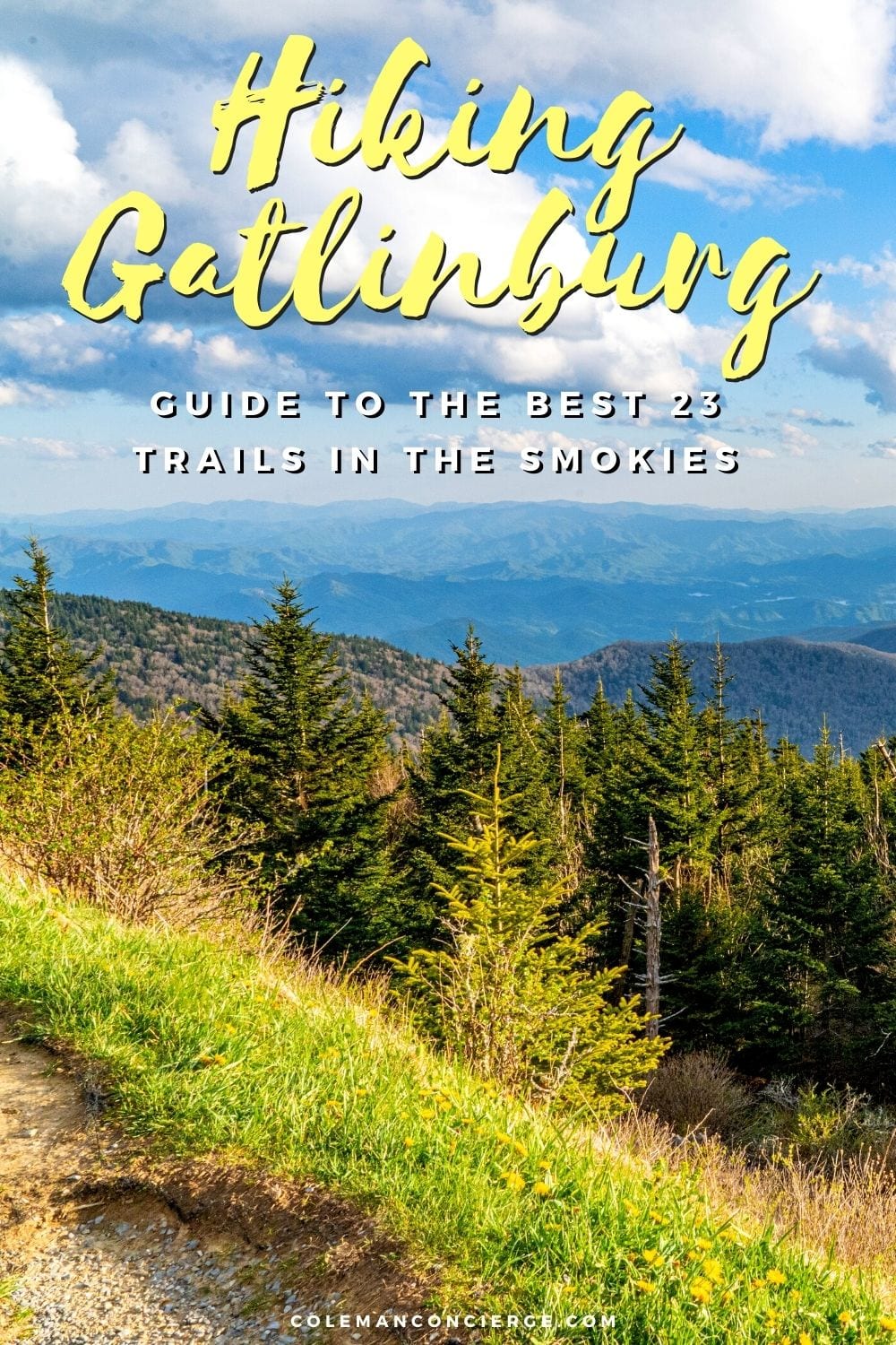
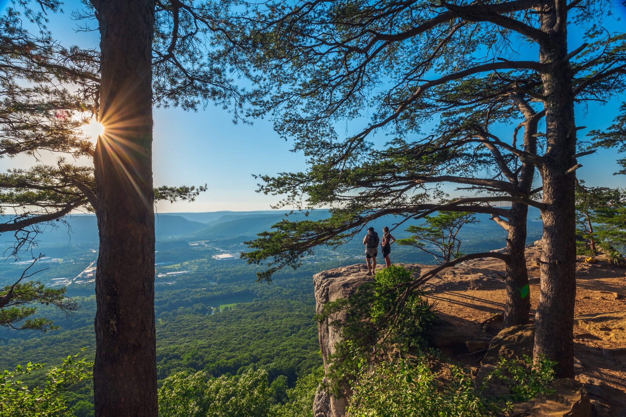
Are you looking to go hiking in Gatlinburg? This guide gives you the best 23 trails around the Tennessee side of the Great Smoky Mountains National Park. Whether you’re looking for easy hiking in Gatlinburg, hikes with waterfalls near Gatlinburg, hiking in Cades Cove, or the most challenging trails in Gatlinburg, we have you covered.
Keep reading to get to our interactive hiking maps, links to detailed descriptions, and some trail humor to keep you smiling as you plan your great escape to the mountains hiking Gatlinburg.
Hiking Tours in Gatlinburg. Top Picks
- Enjoy scenic views of The Great Smoky Mountains on this Thundering Streams and Falls of the Smokies Guided Hiking Tour
- Learn more about The Great Smoky Mountains National Park’s wildlife diversity, history and just enjoy the views: Hidden Cascade Hiking Tour in Great Smoky Mountains from Gatlinburg
- Find out more about the history and nature of The Great Smoky Mountains on the Explore a Simpler Time Smoky Mountain Tour with a guide


Table of Contents
Interactive Map for Hiking in Gatlinburg
Below is the interactive map for hiking in Gatlinburg. It’s divided into the same sections as this guide and color-coded:
- Easy hiking in Gatlinburg is in purple / green
- Hikes with waterfalls near Gatlinburg are in blue
- Hiking in Cades Cove is in orange
- The most challenging trails in Gatlinburg are in red
The trailhead, route, and points of interest are included for each hike. Take a little time, click in, zoom around, and explore. You can even switch to click on the route lines for a brief hike description. In addition, the trailheads and points of interest have pictures.
When you’re ready to hit the trail, you can download this map to your smartphone. Do this from town because cell service is sketchy in the Great Smoky Mountains National Park. Even if you can’t get navigation to work, you can always follow your marker around the map. You might want to download the entire map area for offline navigation while you’re at it. We’re pretty proud of this interactive map, so it or any other of our embedded maps don’t show up, just hit the refresh button, and they should appear .
Index to the Best 23 Hiking Trails in Gatlinburg
Below is every one of the 23 hiking trails in Gatlinburg in this guide listed in a convenient table for people who want to hike shop by distance, rating, or elevation gain. Our full hiking descriptions are hyperlinked to the names in the table, so click on whichever one strikes your fancy.
| Hike | Length | Gain | Rating | Notes |
|---|---|---|---|---|
| Roaring Fork Motor Nature Trail | N/A | N/A | Easy | Driving loop with hiking options |
| Cades Cove Loop | N/A | N/A | Easy | Driving loop with hiking options |
| Cataract Falls | 1 | 29 | Easy | Sugarland Visitor Center to Cataract Falls |
| Elijah Oliver's Place Trail | 1.2 | 98 | Easy | Short trail to a historic cabin |
| Cades Cove Nature Trail | 0.8 | 30 | Easy | Short loop off the Cades Cove Campground |
| Metcalf Bottoms | 1.5 | 187 | Easy | Out and back to 19th century schoolhouse |
| Laurel Falls Trail | 2.4 | 396 | Easy | The most photographed waterfall in the Smokies |
| Clingmans Dome Observation Tower Trail | 1.2 | 331 | Easy | Paved trail to the high point observation tower |
| Gatlinburg Trail | 3.8 | 164 | Easy | From the town to the visitor center (and back) |
| Trillium Gap to Grotto Falls | 2.6 | 544 | Moderate | Grotto Falls are the ones you can walk behind |
| Baskins Creek to Baskins Creek Falls | 3.1 | 912 | Moderate | A waterfall hike of Roaring Springs Motor Trail |
| Grapeyard Ridge to Baskins Creek Falls | 3.1 | 787 | Moderate | Less elevation gain than Baskin Creek trial head |
| Abrams Falls Trail | 5.5 | 629 | Moderate | Largest Waterfall in the Smokies by volume. |
| Rainbow Falls Trail to Rainbow Falls | 5.5 | 1640 | Hard | Popular hike to large waterfall |
| Rich Mountain Loop | 8.3 | 1199 | Moderate | Loop hike with waterfall |
| Gregory Bald Trail | 10 | 2552 | Hard | Out and Back to Gregory Bald |
| Anthony Creek / Leadbetter Ridge Loop | 12.9 | 3250 | Hard | Loop Trial to to the ridgeline, AT, and Rocky Top |
| Alum Cove to Peregrine Peak | 4.2 | 1,059 | Moderate | for people who don't want to do all of Mt LeConte |
| Chimney Tops | 3.3 | 1487 | hard | Short, steep climb to the summit and spectacular views |
| Charlies Bunion via Appalachian Trail | 8.6 | 1981 | Hard | One of the most majestic viewpoints in the park |
| Ramsey Cascade Trail to Ramsey Cascade | 8.1 | 2224 | Hard | Largest waterfall in the Smokies by height. |
| Alum Cave to Mt LecConte | 10.6 | 2919 | Hard | The "easy" way to Mt LeConte |
| Rainbow Falls to Mt LeConte | 13 | 4002 | Hard | Hike to the highest point without a road |
Easy Hiking in Gatlinburg
We consider easy hiking in Gatlinburg to be trails under 4-miles long with less than 400′ of elevation gain. There is going to be a certain amount of overlap in trail classifications. Some of these hikes are in Cades Cove, and others have waterfalls.
However, these hikes are grouped from a visitor’s perspective just looking for an ‘easy’ hike. If you just want to get out and explore nature in the Great Smoky Mountains National Park, this list is a great place to start.
Pro tip: Download AllTrails+ for a one-stop shop app for planning all of your hiking, biking, and camping adventures.
Roaring Forks Motor Nature Trail (car loop)
Our first ‘hike’ is actually a 5.5-mile one-way loop through the mountains just outside of Gatlinburg. Pretty easy, right? Several other hikes in this guide come off of this loop. There are also opportunities to park and explore historic cabins and small waterfalls just a short distance from the road. If you stop and explore every roadside attraction, you’ll still probably walk less than a mile on your Roaring Forks Nature Trail outing.


Cade Cove Loop (car loop)
Much like Roaring Forks, Cades Cove Loop is a one-way driving loop through the national park. However, Cades Cove has significantly more historic buildings and less forested regions than Roaring Forks. You also have a legitimate chance of wildlife sightings like bears, elk, coyotes, and turkeys.
Enough is going on here that we have written a separate Cades Cove Loop guide. However, here’s the skinny. Most of the cabins, like at Roaring Forks, are more or less roadside. Some structures, like John Oliver’s Place, weren’t quite far enough away to be considered ‘a hike’ in and of themselves, while others, like Elijah Oliver’s Place, were. However, any substantial hike is discussed in the Hiking Cades Cove section.


Cataract Falls (1-mile)
Cataract Falls is a little waterfall in the woods right by the Sugarland Visitor Center. Parking at the visitor center and hiking in is the best way to visit Cataract Falls because there’s easy parking and a wide, pea-gravel trail along Fighting Creek. It’s an enjoyable enough hike that you don’t even need to try and get one of the five or so parking spaces at the Cove Mountain Trailhead to shave a few tenths of a mile off the hike.
The trail from Sugarland Visitor center is huge, flat, and easy to follow. One thing to note, if you’re running Google Navigator on walking mode, it will try and take you through the Park Headquarters. Don’t do that. Instead, stay on the Fighting Creek Nature Trail until it comes to a 4-way intersection. From there, take the Cataract Falls trail to the right and proceed to the falls.


Elijah Oliver’s Place Trail (1-mile)
Elijah Oliver’s Cabin is a well-preserved homestead about 1/2 mile off Cades Cove Loop. The cabin, barn, stable, smokehouse, and corn crib are in their original locations, and you can imagine what life must have been like for Elijah when he returned home from the War Between the States. It’s just far enough off the road to qualify as a “hike” in this guide.
There are several ways to get to the cabin, but the easiest is to park at stop ten on the Cades Cove Loop, which has signage indicating it’s the parking for Elijah Oliver’s Place Trail. It’s almost more of a road than a trail, but all you have to do is stay on the main path, and you’ll reach the homestead. After you’ve had your fill of exploring, head back the way you came.


Cades Cove Nature Trail (.8 miles + approach)
Nature trails sound lovely, don’t they? I mean, if you’re a hiker, you love both nature and trails. The reality of the nature trail is a little different. If you’re staying in the Cade Cove campground, then definitely hike the Pine Oak Nature Trail. Otherwise, you’ll spend about as much time wandering through the campground as you will on the trail, and there are probably better options for you in this guide.
Day visitors need to park at the ranger station/camp store and hike through the campground to the trailhead. From there, you can start the Cades Cove Nature Trail. On the bright side, this loop hike packs a lot of diversity over a little distance. You’ll have a couple of creek crossings of Copper Branch and climb 240′ up to a small knob. The valley is filled with rhododendrons, which should be in full bloom around Father’s Day.


Metcalf Bottoms Trail (1.5 miles)
Metcalf Bottoms Trail is a real gem because cabin hounds and waterfall chasers often overlook it. You can almost always find parking and find quiet spots on the trail once you leave the picnic area. On the downside, there is very limited parking at the physical trailhead across the Little River bridge, so plan to park in the picnic areas and walk over.
Once you reach the trailhead, there a short, flat bit along the river, then you go up and over a small azalea-covered hillside. After joining back up with Brier Branch Creek, you’ll soon reach the historic 1882 Little Greenbrier Schoolhouse. This 20X30 building is the most prominent remains of the Little Greenbrier ghost town. The last class was held in 1936; then, the park absorbed the town and surrounding land.


Laurel Falls Trail (2.4 miles)
Laurel Falls is the most photographed waterfall in the Smokies. I debated whether it should be in the waterfall hike section or the easy hike section. In the end, I thought that hikers looking for quick and easy hikes could use this information more than waterfall chasers. Laurel Falls is an extremely popular hike for a reason, and its only fault is that it’s so darn popular that you might have a hard time finding parking. Consider making this your first or last hike of the day so you’ll avoid the mid-morning rush.
The Laurel Falls Trail is a 2.4-mile out-and-back that’s paved the entire way up. It’s not ADA accessible, and you probably shouldn’t take strollers on it. It also gains about 400′ of elevation, but it’s a doable do for anybody in reasonable shape. And your reward is quite possibly the most beautiful waterfall in the Smokies.
Laurel Falls will have a temporary Visitor Experience Stewardship plan in effect from September 7, 2021 to October 3, 2021. During this time, there will be a $14 parking fee and reservation required We’ll keep our eyes on how this project goes and update this page if there are any changes to Laurel Falls access.


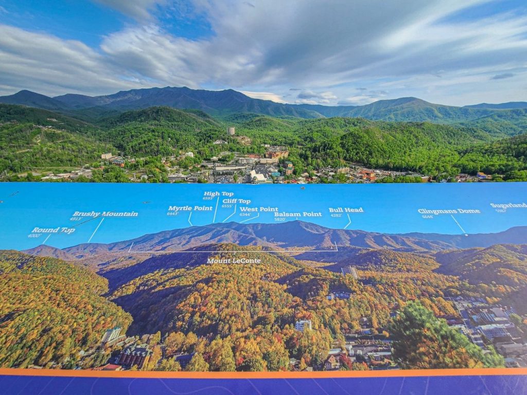
Clingmans Dome Observation Tower Trail (1.2 miles)
At 6643′, Clingmans Dome is the highest point in the Great Smokies. The park service built a 45′ tall tower with a 375′ ramp to give visitors sweeping 360-degree views. The curving ramp looks almost like a nautilus or parking ramp, depending on who you ask. It’s one of the most iconic structures in the park, and you’ll find it well represented at all the tchotchke shops in Gatlinburg.
An astute reader will realize that the 1.2-mile Clingmans Dome hike comes after the 2.4-mile Laurel Falls hiking in difficulty. No, this is not a typo. 6000′ is at the lower elevation for altitude sickness. While that’s rare, it is harder to make the 400′ climb than you might think. Not only is the air thinner up there, but it’s also 25 degrees cooler than Gatlinburg and usually windy, so bring a jacket. Maybe even bring two jackets if you’re waiting for the best sunset in the Smokies. Oh, and you’ll also cross the Appalachian Trail, so be sure to take a picture and a step or two so you can technically become an AT hiker.


Gatlinburg Trail (3.8-miles)
The Gatlinburg Trail is the last of our “easy” trails. At 3.8 miles, it’s on the borderline of being considered easy. However, since it leaves right out of town, it’s certainly one of the easiest to reach. You also don’t need to finish the entire thing since it ends at the Sugarland Visitor Center, and you can always just drive there.
In my mind, the Gatlinburg Trail is a getaway from the crowds on the Parkway. When you decide that you have enough of the masses of humanity looking for the perfect Clingmans Dome tchotchke in town, you can hike the trail. Even a 1/4-mile in the woods might be all it takes to remember that you are, in fact, at the gateway to the Smokies when you are in Gatlinburg.


Hikes With Waterfalls Near Gatlinburg
Listen here, all you waterfall chasers. We have already written a fabulous guide to Hikes with waterfalls near Gatlinburg….Oh, you’re still here? Then you must be interested in hiking and waterfalls!
Here’s our list of hikes that you would choose because they end in waterfalls. Once again, they are listed in increasing order of difficulty. These are all moderately difficult hikes, except for Rainbow Falls, which is considered hard.
Trillium Gap to Grotto Falls (2.6 miles)
Grotto Falls’ claim to fame is that it’s the one you can walk behind. That’s right. The trail goes around behind the falls, and you can look out through the water. It’s the perfect end to 544′ of sweaty climbing. You can cool off without getting your shoes soaked.
Perhaps what’s harder than the Grotto Falls hike is finding a parking spot. There’s a little parking lot before the trailhead that’s almost always full. After that, you have to find the best “bad” parking space along the side of the Roaring Forks Motor Nature Trail. The trailhead is about halfway around the loop, just about at the highest point on the road. If you pass up a spot, you’re not going to be able to come back to it. I’ve seen cars parked about 1/2 mile down the road and 200′ down the hill on busy days. I’ve also seen overconfident drivers high centered on rocks, so there’s a penalty for picking too early too. Your best bet is to leave early enough to find a spot without playing parking roulette.


Baskins Creek Falls (3.1-mile)
Baskins Creek Falls is a secluded 80′ waterfall located at just about the geographic center of the Roaring Forks Motor Nature Trail. You can either take Baskins Creek Trail or the Grapeyard Ridge Trail to falls. They are both a 3.1-mile out and back with similar gain. How do you decide which one to take?
Here are my thoughts. You want to start your day either hiking to Grotto Falls or Rainbow Falls. These are the A+ hikes in the area. Baskins Creek is either a backup plan or a bonus hike before returning to town. The Baskin Creek parking area is entirely too early in the loop to commit to parking and hiking. You’d want to make it to Grotto Falls to find your spot there before it gets all kind of funky. Instead, look to start from the Grapeyard Ridge Trail after you’ve done your other hikes for the day. Plus, it’s 100′ less gain to come in that way, and you can check out the Alex Cole Cabin without reparking your car.


Abrams Falls (5.5 miles)
Abrams Falls is the largest waterfall in the Smokies by volume, even though it only has a 25′ drop, and it’s located at the back of Cades Cove Loop. It has an enormous parking area, so you don’t have to make a mad dash for the trailhead. In fact, you might want to make a loop around the cove first to see if any bears came out to play. After roadside animal watching, then start your hike.
The Abrams Falls Trail is undergoing major renovations in 2021. However, it will be fully open Friday through Sunday each week and on federal holidays. You climb up and over a 200′ ridge in the middle of the trail before descending down to the falls. Be careful around the falls because, with all that water, there are powerful and dangerous hydraulics at the base.


Rainbow Falls (5.5 miles)
The hike to Rainbow Falls is enormously popular near the Roaring Fork Motor Nature Trail. So popular, in fact, that they built a second parking area, and they still both fill up on weekend mornings. Luckily, you can loop back around here because you haven’t reached the one-way section of the motor nature trail yet. However, you can end up adding about a 1/2 mile to an already challenging hike that gains over 1600′ on the way to Rainbow Falls.
The trail continues to Mount LeConte for brave, adventurous souls (soles?). However, the falls themselves justify the trip. They drop 80′ straight off the cliff in one dramatic plunge. The flow drops to a trickle in the middle of the summer, so this hike is best done in the spring waterfall season. In fact, with good water, it’s almost a ‘must do.’


Hiking in Cades Cove
This guide already has some easy hikes in Cades Cove and an epic waterfall hike to Abrams Falls. What’s left are moderate and hard hikes that climb out of the valley and up to the surrounding ridgelines and peaks. If that sounds like fun to you, you must be a hiker, and we have a few trail suggestions for you to go hiking in Cades Cove.
Rich Mountain Trail (8.3 miles)
The Rich Mountain Loop is an 8.3-mile heavily trafficked loop trail. It takes you by Crooked Arm Cascades and up Cerulean Knob. You end up gaining 2000′ on the loop, and you still need to do a little bushwhacking to get to the cascades.
The user-friendly part of the trail comes from the trailhead location. It’s just past the entry gate, so you could theoretically hike this trail at first light (if you’re one of those people) before the park opens for vehicle traffic. You can also cut Cades Cove Loop short by exiting Sparks Rd, about a mile into your journey. You also get to visit John Oliver’s Cabin for only a few extra steps since it’s right off the Rich Mountain Loop Trail.


Gregory Bald Trail (10-miles, if the road is open)
Gregory Bald Trail takes you to Gregory Bald from Forge Creek Road. The road is seasonally closed from November through March, but it’s closed due to hazard trees, so I haven’t hiked this trail. You should check the NPS Road page to see if the road has opened. Otherwise, this is a much (much) harder hike up from the North Carolina side.
However, if (or when) you do make this hike, be sure to do it during the peak of azalea bloom which generally occurs between June 10 and June 25. Gregory Bald is at the mixing point between Flame Azaleas and Cumberland Azaleas. The genetic pool is more of a torrential whirlpool with the species free intermixing, creating new beautiful strains and species every year.


Anthony Creek Trail (13.1 miles)
The Anthony Creek / Leadbetter Ridge Loop is almost a perfectly designed lollypop loop rising from the valley floor and climbing to the ridgeline. You get to start outside of Cade Cove Loop, so there’s no worrying about traffic jams waiting for that one idiot who parks in the middle of the road to watch bears frolicking in the fields. It also has a substantial portion of the trail (~20%) that travels the ridgeline itself. Highlights along the trip include Spence Field, Russel Field, and the views from Rocky Top.
The hike begins in the Cades Cove Picnic Area, where you take the Anthony Creek Trail past the horse camp and all the way up to the ridgeline. From there, check yourself. If you’re feeling great, continue up to Rockytop. If you’re hating life, turn back and the way you came. However, you want to follow the ridgeline back to the Russel Field Trail and form a loop if you possibly can. Not only are loops generally cooler, but the ridgeline is also where you’ll see the azalea show in June that’s similar to Gregory Bald.


The Most Challenging Trails in Gatlinburg
There are rules when defining challenging hikes. Like, they’re reasonably done in a single day without running, and they’re not hard because somebody kicked you in the nuts first or put rocks into your pack. Either way, if somebody is messing with some combination of your rocks and your sack, you can’t count that towards trail difficulty. Although, you might re-consider your choice of hiking partners. With that said, let’s get the list of challenging hikes around Gatlinburg going. Same format as before, where the trails are in order from least challenging to most, although these are all challenging trails in Gatlinburg.
Alum Cave to Peregrine Peak (4.2 miles)
Alum Cave to Peregrine Peak is like Mt LeConte light. You gain about 1/3 of the elevation and hike about 1/3 of the distance if you stop at Peregrine Peak. You still gain a little over 1000′ in 2 miles (4.2-mile round trip), so it’s still a challenging hike.
You get many of the trail highlights to Mt LeConte, too, like the staircase through Arch Rock, the views from Inspiration Point, and walking through the historic Alum Cave Natural Shelter. What you don’t get is miles and miles of walking along the ridgeline asking, “are we there yet?” as you climb yet another false summit.


Chimney Tops (3.6 miles)
There was a time when Chimney Tops was the premier trail in the park. For a minimal gain, you could get an optimal view. However, in November of 2016, a devastating fire swept through the area. That fire jumped outside of the park, killing 14 people and destroying many homes and buildings in the area. It also left the Chimney Top Pinnacles damaged beyond the safety point. The Park Service worked to repair this popular trail, and it reopened in October of 2017 with a new observation deck, located roughly a quarter-mile below the actual summit.
The rebuilt Chimney Top trail is a 3.6-mile round trip, gains 1487′ of elevation, and has an excellent view of Mt Le Conte and the pinnacles. It has fabulous bridges and some of the trail improvements from the 2012 Forever Wild repair project. It’s a beautiful hike, but if somebody is gushing over the trail, check to see the last time they went up. If it’s before 2016, then put an asterisk on their trip report.


Charlies Bunion via Appalachian Trail (8.6 miles)
Believe it or not, this trail was actually named after Charlies bunion. The Charlies Bunion rock outcropping was known as Fodderstack. One day, early advocates for the Great Smoky Mountains National Park Charlie Conner and Horace Kephart stopped for a break on Fodderstack. Charlie’s feet hurt terribly, and he took off his boots during the rest. Horace looked over and, upon seeing his offending bunion remarked – “Charlie, I’m going to get this place put on a government map for you.” The rest, as they say, is history. These are the sort of hiking buddies you want. They immortalize your feet instead of low-brow rock-sack humor.
Not only do you get a little history lesson here, but you also get to hike 8.6 miles on the Appalachian Trail. That counts for more points somewhere than taking a step or two off the paved path leading to Clingmans Dome. You also gain over 1500′ and reached remarkable viewpoints like The Jump-Off the Charlies Bunion outcropping. By hiking this trail, you will have earned your proverbial bunions. One final note on hiking friends… Horace Kephart might have named the rock outcropping after his buddy’s aching feet, but he named the entire dang mountain after himself.

Ramsey Cascade Trail to Ramsey Cascade
Ramsey Cascade is the largest waterfall in the Smokies, with over a 100′ drop over several tiers. You also get to hike through one of the last remaining old-growth forests in the park. However, it comes at a price for your legs and lungs.
The Ramsey Cascade Trail climbs over 2200′ in with an 8-mile round trip. The trail also gets very rugged over the last 1/3 mile before the falls. This trail is not for the faint of heart. Or weak of heart. Or people who faint because there’s also a 20′ high footbridge that you’ll have to cross. This is definitely a hiker’s trail, which is one of the reasons it’s in the challenging hike section and not the waterfall section.


Mount LeConte (11 miles +)
While Clingmans Dome is the highest peak, there’s also a road almost all the way up it. You have no such luxuries at Mt LeConte, the second-highest mountain in the Smokies. Five separate trails lead to the summit: Rainbow Falls, Bull Head, Trillium Gap, Boulevard, and Alum Cave. However, we’ll only consider the two easiest – Alum Cave (11-miles/3000′) and Rainbow Falls (13-miles/4000′).
Which is better to summit Mt LeConte, Rainbow Falls, or Alum Cave? It all depends where you’re coming from. We’ve discussed both hikes already, so you know that Rainbow Falls comes off of Roaring Fork Motor Nature Trail and passes by a large waterfall, and Alum Cave comes off of 441 and passes by impressive rock formations. The choice is obvious if you want to summit Clingmans Dome or drive the motor nature trail after hiking Mt LeConte. If you have a really good friend willing to drop you off at one and pick you up at the other, you don’t even have to choose. But you should at least buy them a beverage of their choice.


Hiking in Gatlinburg FAQs
Is Gatlinburg good for hiking?
Yes! You can even hike while barely leaving downtown. Head to the Roaring Fork Motor Nature Trail for a driving loop with several hikes.
What is the easiest waterfall to see in Gatlinburg?
Cataract Falls. This is most likely the easiest hike. Head to the Sugarlands Visitor Center and you’ll see signs pointing you in the direction of Cataract Falls.
What is the famous hiking trail in the Smoky Mountains?
The hike you’re most likely thinking of as the “most famous” is Mt Leconte and there are several different trails that you can take to reach its summit.
Wrapping up Hiking in Gatlinburg
Almost 4,000 words later, and you’re still here. We hope that you enjoyed this guide and that it has inspired you to go hiking in Gatlinburg. Spring hikes are the best for waterfalls and wildlife. Summertime brings wildflowers and blue skies. Of course, don’t forget the fall foliage season, where the hillsides transform into a vibrant tapestry of orange, red, and yellow.
Places to Stay in Gatlinburg
Ready to Book Your Trip? These Links Will Make It Easy:
Car Rental:
- Need to rent a car? Discover Cars will get you on the road without breaking the bank!
- If you are brand loyal, you can also book directly through Alamo Rent-A-Car or Thrifty Rent-A-Car
Lodging:
- We loved staying and the beautiful all-inclusive Sandals Royal Curacao and we think you will too! Book your Sandals getaway now!
- From hotels to private homes, find the perfect accommodation with Hotels.com, VRBO, Expedia, or Booking.com.
- You can also book direct through Hilton Hotels
Our Packing Favs:
- Travel in style with a suitcase, carry-on, backpack, or handbag from Knack Bags
- Packing cubes make organized packing a breeze! We love these from Eagle Creek
Attractions/Activities:
- Save on tickets to attractions, sightseeing tours, and more with Tiqets
- Get Your Guide and Viator for guided tours/excursions, day trips, and activities
- Want to learn a city from the ground up? Take a small group walking tour with Walks – 5-star rated with a Tripadvisor Certificate of Excellence
- Want to book an epic adventure experience with top-notch companies like Intrepid Travel, G-Adventures, or Backroads? Check out Travelstride
- Find information on local trails with the All Trails App.
- Need something else to plan your perfect trip? Visit our Resources Page for more trusted partners
Like it? Pin it for later on Pinterest!


 Hi! We are Jenn and Ed Coleman, and together we are Coleman Concierge. It is our goal to inspire you to get out, expand your world, and to seek adventure, even in your own backyard.